
This is where Shirley dropped us off at the Catalina Highway near Molina Campground. All fresh and ready for a 37.5 mile hike over the top of Mica Mountain and back to Vail near Colossal Cave. Turns out my Fit Bit measured a total of 62.27 miles over the three days. Setting up camp, packing up camp, finding fire wood, getting water to filter... all the side trips along the way to explore, take pictures, etc. It all adds up.

These Arizona Trail markers sometimes have arrows to guide the hikers along the path.
Larry has a lot of backpacking experience, having completed the Appalachian Trail last fall... so one night he came over and helped me figure out what all I needed to take along. He told me all the right stuff... but I am a slow learner and it wasn't until the first night I realized how badly I screwed up. For example, he told me that I should have two sets of clothes. One set to wear outdoors, and another set for inside the tent... for sleeping. That way you can have dry clothes to sleep in even if the day clothes got wet or sweaty. On the first night I realized I didn't bring any "inside tent" clothes... plum forgot. Plus it would be nice to change underwear... and not just change the drip pad. After hiking 20 miles in a day carrying 38 pounds on your back, those undies were totally soaked with sweat. So I was really glad that we just bought a comfy sleeping bag liner that is easy to just throw into the laundry.

I really like the large Arizona Trail signs at key trailhead locations, showing check points and distances. As soon as we got to the next check point, I would ask Larry how far to our next goal.

The Arizona Trail was born into being the year of the Arizona Centennial... 2012. By connecting several existing trails and then building a few connecting links they completed the 820 mile trail network from the border of Mexico to Utah. The Quilter Trail was one of the last links built... on our third day we got to hike that section.


There were a large number of this Goodding Verbena along the beginning of the trail.

These photos were taken above the 4500 foot elevation. This plant was also on the other side of Mica Mountain as we came down. Didn't see these at the lower elevations.

Looking back to our starting point on Catalina Highway and Molina Campground.

The views are spectacular... and they just go on and on.

We saw several of these bike friendly Texas gates to keep the cattle contained.

Pretty flower, but there is no such thing as a good thistle... they are all noxious weeds... non-native invasive plants.

But I struggled to know the name of this one. I know it's not the Russian Thistle (tumbleweed) or Canadian Thistle...which has the smallest blossom and head. Maybe it is the Musk or the Scotch Thistle. Help me if you know.

Within the first hour of our hike we were looking at Mica Mountain in the distance. Holy Cow! It must be still almost 20 miles away to the peak... and over 4000 feet elevation higher to climb with 38 pounds on my back.

Is this not a most gorgeous, transparent cactus blossom? What is that bug up to?

On our first day we we met 10 other hikers on the trail. Four of them were thru hikers... and this couple from Washington State recognized Larry from last Thursday's Del Webb hiking club on the Rincon Valley Passage which starts at the Gab Zimmerman Trailhead going north. It was like meeting old friends!

I just love the Molina Basin part of the trail. Vast areas of grassland makes ideal ranch land.

On this side of the mountain we did not remember seeing any Saguaros or other cactus. But we did see some cattle and horses grazing.

What cute little, tiny yellow flowers... Spreading Fanpetals.
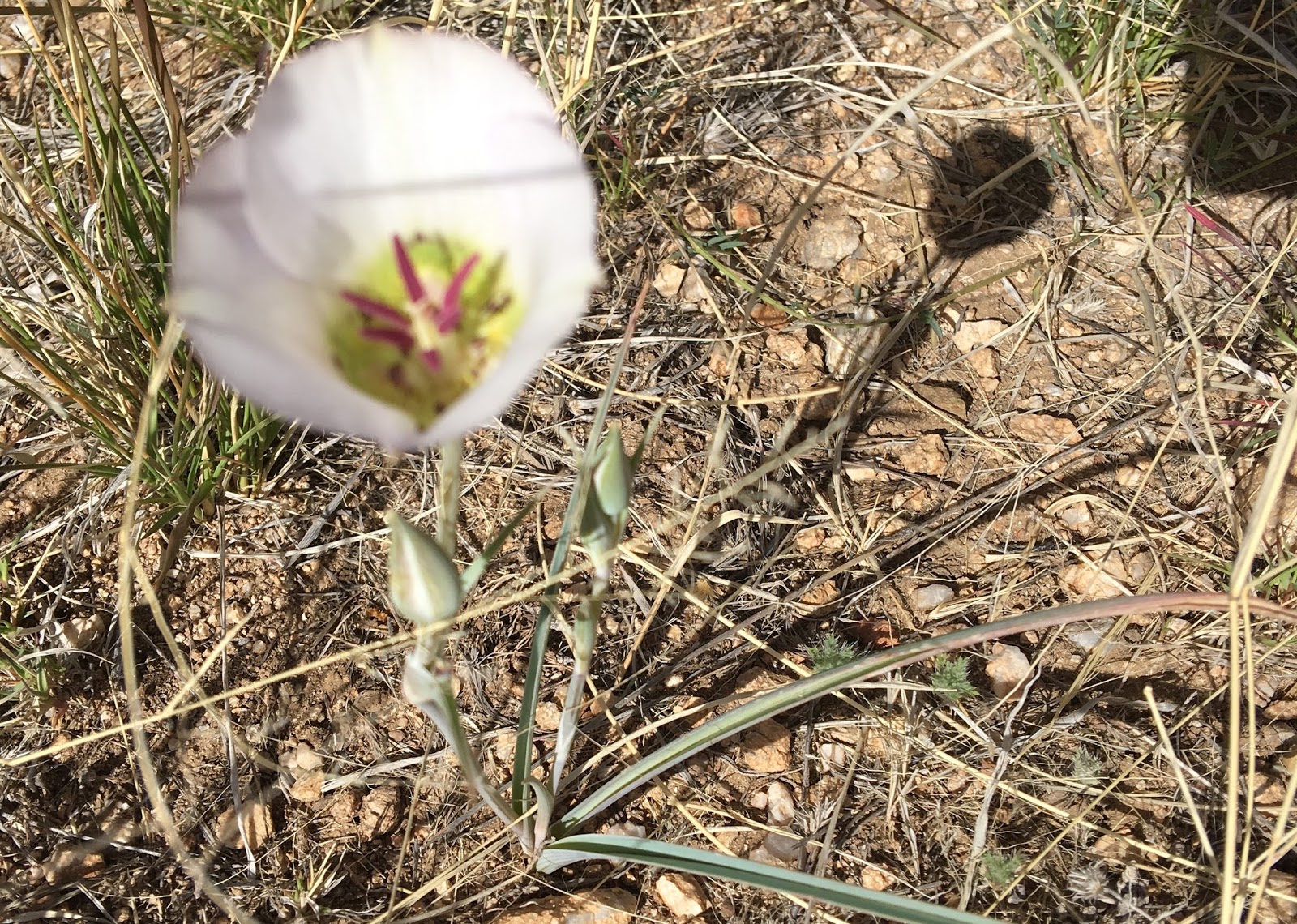
And we occasionally saw a few Mariposa Lilies.

As we got closer to Mica Mountain the trail wound between occasional Ocotillos... and the open meadowland gave us no protection from the increasingly stronger, cold wind. More than once we each had to run after our hat. The wind actually blew us off the trail at times.

We made it to Redington Road Trailheaad by 3:45 pm... but my legs were starting to talk to me. We had been walking quite steady at the rate of about 2 miles per hour thru the Molina Valley, hoping to set up camp near the Italian Trap. I was a little curious why they called the place Italian Trap... and was not sure it would be my choice to sleep. Who would want to sleep in a trap? But I was feeling so wasted I would settle for any place as long as it was out of the wind.
For some reason neither of us realized missing any sign of Italian Trap. We were both really dragging having hiked about 16 miles. My Fit Bit registered 42,069 footsteps... which was almost 10,000 more than my previous record. And never had I done that much carrying 38 pounds on my back!
Plus, we were doing this hike going from north to south, and all the trail signs and printed datebook trail info was formatted for hikers going from south to north. It was my suggestion to do it backwards since the starting point was over a thousand feet higher than our ending elevation and our final day of the three-day adventure would be mostly downhill with lighter backpacks. Plus it would be nice to be able to have cel phone service to call for a pickup after the hike, and at the other end cell phone service may not be possible. Turns out there was none.
The other crazy fun advantage of doing it backwards we got to see most of the hikers who go from south to north, so every day we got to see a lot of thru hikers... as well as several short distance hikers like ourselves. We met 10 hikers the first day, only 4 hikers the second day and on the third day none until we were on the Quilter Trail we saw three guys from Colorado... and then on our final leg of the journey a husband and wife and a whole troop of bikers... maybe 20 in all.
Larry said that previous history showed about 12 thru hikers hiked the entire trail last year... but on our 3 day adventure we talked to everyone we met on the trail and if all of those we talked to actually finish the whole thing, there would be 12 more thru hikers! Larry said that this looked like a breakout year for the Arizona Trail and predicted that there would be a new record of hikers who finish the entire trail this year.
By 5 PM. we were both ready to call it a day. We came to a wash and decided to look around for a suitable place to set up our camp... and after about 15 minutes of looking decided that the soft level sand on the edge of the wash would be just fine. We were confident that that no rain was in the offing, so should be safe for this one night.

Larry was the first to get his tent set up... but it was a real trick to keep the tent from blowing away. The wind was so fiercely strong. We soon learned how to use the plentiful rocks to to our advantage.

I was a little slower getting my tent set up. I could hardly remember how to do it... and at first put the water membrane on upside down before I realized that there were tabs on the other side for the middle cross rod to connect. The logo MSR needed to be readable from the outside. I soon had my little abode secure with rocks not only on the outside, but also some on the inside corners. And fortunately as the sun went down, so did the wind.

Larry was the first to get his supper cooked and then he helped me get my little stove set up and started.

I had never used one of these cute little stoves before... but it worked like a jiffy and a few minutes had enough water boiling to pour into my Backpackers Pantry Gourmet. Larry told me about Pan Thai, so when I saw it on the shelf at Big 5 Sports I grabbed it without even reading the label. He told me that when the label says "Two Servings" that it was about right for one person.
Shirley wanted me to check my blood score to see how my diabetes reacted to this excessive exercise... so I did.While my tasty supper was hydrating with the boiling water I did the finger test and my blood score showed 146... higher than I expected... likely ate too much beef jerky. Hard to know how much sugar they put into that jerky. The Pan Thai was very tasty and spicy, but I couldn't eat it all, so Larry was happy to finish it for me.
I took my Metformin pill and after two hours checked my blood score again... 204!!! Holy Cow! I grabbed the package and read the label. It said 18 grams of sugar per serving... and I ate almost two servings! I was shocked... blown away! The next day I gave Larry the rest of my beef jerky and the next night when we camped I opted to make a healthier Cream of Broccoli soup that showed only 3 grams of sugar... much better.
That first night I was wondering why I got myself into this predicament. Here I was about 14 miles from where we started. My one leg was talking to me... telling me I had overdone it today and needed to not push my luck. If there was a way to get out right now, I would have taken it. As we were coming to the trailhead that morning we stopped at Walgreens to get some Ben Gay, just in case I got some sore muscles. So as I was going to bed I was pretty generous in rubbing it on both legs, my hips, and my shoulders. I was one smelly, sticky, gooey mess. Carrying a heavy backpack all day I discovered some muscles I never realized I had. How could I possibly hike out of here? Should I go forward or turn back?
"That night I slept like a baby... cried for hours before going to sleep."

The next morning we were a little slow getting going. It was about 8 AM before we were packed up and ready to hit the trail. I resolved to take it a little easier and surprisingly, there was no pain in my legs. Our distance today would be less... about 9 miles, but the elevation gain of about 4,000 feet carrying 38 pounds on your back more than made up for it. It was a serious days work. In the back of this photo is our goal... the top of Mica Mountain. Little by little it was getting closer.
"The best way out is always through."
– Robert Frost, American Poet

Day Two was another beautiful sunny, non-windy day. In the first hour we met a thru hiker, his name was Guy... an iron-man athlete from Wales. We also met Scott who I had met Sunday afternoon when checking out Colossal Cave access to the trail in case we decided to hike that far. Scott was re-stocking his pack and had too much food to carry, so was going to throw the extra away. He was glad to give it to me. I told him we would likely cross paths as we would be coming south as he went north. As we stood there talking a couple of girls caught up to him... they had been kind of hiking together for the last three or four days. In all we probably saw a dozen thru hikers planning to do the whole trail.

By about 10:30 we had reached Tanque Verde Canyon and there was a beautiful stream of clean water. Larry showed me how to use the Sawyer water filter. It worked great. But it took us about 15 or so minutes to get all our separate containers filled and our water bladders topped off.

As we started to climb up the mountain, the topography was changing. When I saw this crazy looking rock on the ridge I zoomed in on it.


Something was draining the power in my iPhone. When I went to bed last night it was down to 40% remaining. So I thought if I used it less I might still have some battery to call Shirley when we got back on the other side of this mountain.
But using it less and putting it into Airplane Mode didn't stop the run away power drain... and by the time we reached Manning Camp it was down to 6% remaining. What a bummer.

By 1:15 we got to a sign that told us just 4.3 miles to Manning Camp. Only problem was as we kept gaining altitude it was getting colder and colder... and the wind had picked up. I was literally freezing. Larry was much better prepared for this elevation than I was.
As we got closer to the top of Mica Mountain we went thru an incredible pine forest. There were old growth trees... some with trunks between 3-4 feet diameter. So awesome! And I was too cold to even think of taking a picture. My fingers were too cold to use the phone camera... so we just pushed on to the top.


"No hike is complete without getting lost at least once." -Larry Doyle
As we got near the summit the signs were confusing. We knew that the Arizona Trail did not go directly past the summit... but there we were... right at the summit! We were off the trail... we were lost! Blow me over and call me Charlie. It was the most fortunate mistake. Apparently a lot of the thru hikers of the AZ Trail don't take the short side trail to the summit. But here we were.

Unlike Rincon, the summit of Mica Mountain really has no view... just lots of trees. It is a little underwhelming, but to be able to look up at this peak from our home in Vail and remember that we walked up on top of it... for me it almost as good as walking on the moon... such a great feeling of accomplishment.
When I was packing for this hike Shirley asked me if I wanted to take along my polo sweat shirt, but I didn't think I would need it, so left it at home. Stupid me! We stopped to add another layer. Larry put on his wind breaker and since I had nothing more to put on he gave me a light sweater, which made a world of difference. So now I was wearing a golf shirt, a long sleeve light weight cotton shirt, and Larry's knit sweater. Larry had gloves and he suggested if I didn't have any gloves, I could wear a pair of socks. Except I couldn't find where I had put the socks... so Larry gave me a pair of socks too. My hands were really frozen and hurting. But the socks got me feeling much better. However, it was a trick to hold on to the walking poles without the use of your thumbs.

We left the summit around 3:45 and I was so delighted to come into Manning Camp just before 5 PM. There was nobody else here yet... and as soon as we found the numbered campsites I shed my backpack and started a campfire. This is right at 8,000 feet elevation, and I was amazed how cold that it was here. Once we got warmed up with the campfire, we set up our tents and cooked up some supper. I was tired and could not get into the sleeping bag fast enough.

One of the coolest inexpensive impulse items I bought for hiking was this little inflatable solar light. It was only $15. You carry it on the outside of your pack and it stores up solar energy, more than enough to give lots of light. On the two nights I used it for not only necessities but also did three or four Sudoko puzzles. The tag in the photo is our hiking permit for Manning Camp, which they asked us to attach to our pack.
The one item that I really wished I had along was either a solar charger for my phone or an auxiliary power supply. Nothing is more frustrating than to be without your phone/camera.
I was suffering from FOLO...
Fear Of Living Offline.
I learned a lot on this first hike and that is one issue I won't leave home without a good solution.

We woke up to frost on the trees... and Larry's water in the squeeze bag was frozen solid. We guessed the temperature got down to 28 or 30 F. We were both quite anxious to get off that mountain, so it didn't take too long to eat breakfast get packed up. We were on the trail by 7:15 AM.

My cel phone was now dead... so when I could see a clear view of the Tucson valley I asked Larry if we could call Shirley to let her know we were ok and that she could pick us up around 5 PM at the X-9 Road trail crossing. Larry also called Amy. I think a couple of wives were pretty happy to hear from their guys.

I printed these maps for the trail we hiked and then mistakenly left them on my desk. I brought the wrong maps by mistake! From the orange arrow on top it is bout 38 miles of trail distance. We tried to estimate our water pretty close so we weren't carrying too much water.

We could see Pistol Hill, one of favourite local hikes close to where we live... and if all went well we would be back shortly after 5 PM. With the water we got from the stream at Manning Camp we were good until we got the Grass Shack Campground. Larry hoped that it would be evident why this camp was called "Grass Shack," It had some grass... but no improvements to suggest even a shack. Maybe somewhere in the past there was a grass shack there.

One of the last links we hiked on 3-day adventure was the Quilter Trail. Being one of the newest links in the making of the Arizona Trail, it had some of the best steps and rock retaining walls. Larry counted the canyons that we had to navigate thru... and there was at least seven. Each canyon involved switchbacks... all the time we were constantly descending. I borrowed this photo and the Manning Camp one from the parks website.

This trail was named after John "Jake" Quilter who died at the age of 26. He was an avid hiker, trail builder and conservationist... and he had a heart attack on the trail. Larry talked to a man at an Arizona Trail meeting who knew Quilter well and worked with him on this section of the trail. Good choice to name the trail in honour of this young man.

We were so happy to see Shirley at we neared the X-9 Ranch Road. When she got there and we weren't there yet she walked about 15 minutes up the trail to meet us. This final day my FitBit showed over 48,000 steps... 23 miles. It is an all time personal record... never to be repeated. We were so happy to be home again. It wasn't until I sat down in a hot bath that I realized I had blisters on the bottom of both feet. Ouch! I asked Larry if this is common. He said on the Appalachian Trail the two most talked about topics were food and blisters. Half the hikers had blisters. He said many of them just put duct tape over them and kept hiking. Yikes! Was that why Larry told me that some hikers wrapped duct tap on their walking sticks in case of any emergency!
As I was taking off my clothes worn for three days to take a bath, I remembered a cute joke that Larry told us.
"Do you know how to tell the difference between a thru hiker and Sasquatch?
One is a dirty, filthy, smelly, hairy creature that lives in the woods and the other is a mythical creature that lives in the woods!"


